(взято от ESA)
Do you call it Kyiv or Kiev❓🧐
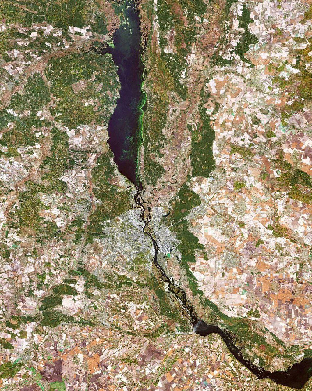
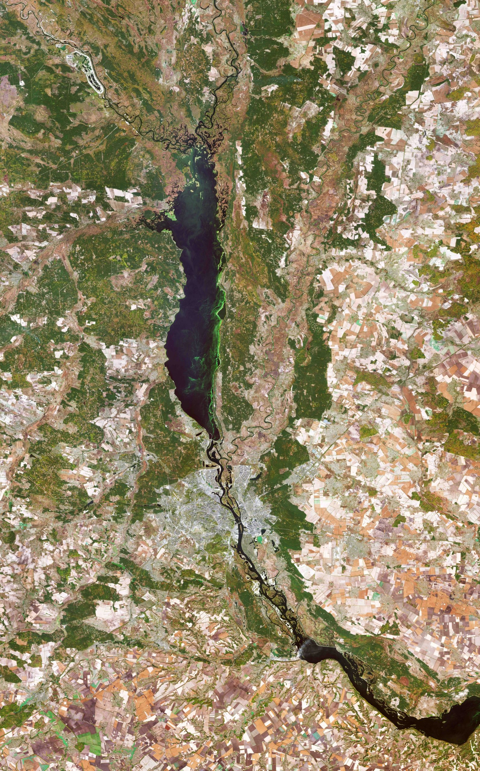
Kyiv, also spelled Kiev, is visible just below the centre of the image, along the Dnieper River in north-central Ukraine. The city covers a total area of around 840 sq km and is home to approximately three million people.
Originally just on the west bank, today the city of Kyiv spreads across both sides of the Dnieper River, which flows southwards through the city. The Dnieper is the fourth-longest river in Europe, after the Volga, Danube and Ural rivers. It rises on the southern slopes of the Valdai Hills of Russia and flows in a southerly direction through western Russia, Belarus and Ukraine to the Black Sea.
Directly above the city of Kyiv is the Kyiv Reservoir – a large water reservoir which is 110 km in length and 12 km in width. The reservoir is mainly used for irrigation, hydroelectricity generation and industrial and public consumption.
The neon green colours in the Kyiv Reservoir indicate a high quantity of algae. Algal blooms are dense layers of microscopic plants that occur on the surface of lakes, or other bodies of water, when there is an overabundance of nutrients on which algae depend. These high levels of nutrients are often caused by human pollution, such as wastewater or fertiliser runoff from agriculture.
Owing to Ukraine’s climate and arable land, agriculture plays a large role in the country’s economy. Large, agricultural plots dominate this week’s image, with corn, wheat and barley being the country’s main crops. With over 40 million hectares of agricultural land covering 70% of the country, agriculture is Ukraine’s largest export industry.