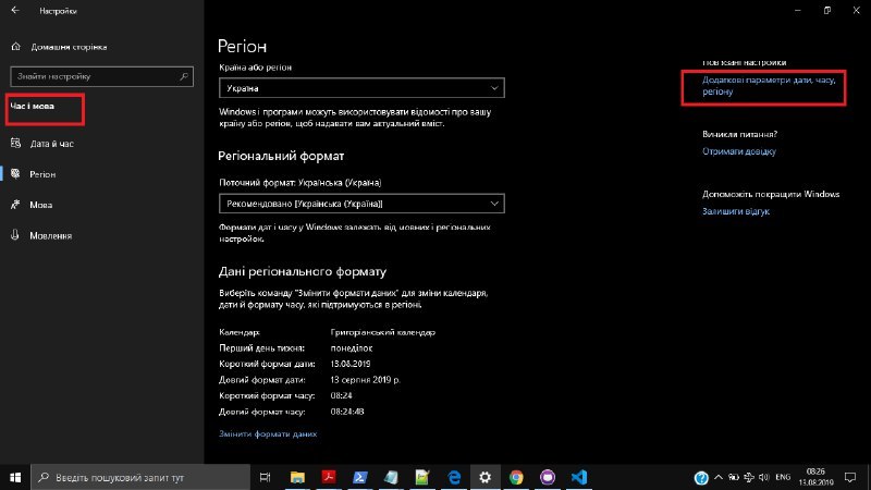
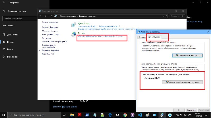
Нагадайте, як в фотки з ГоПро прошити gps-координати з трека?
Запускаю:
mapillary_tools process --advanced --import_path "t1" --user_name Sergey82K --geotag_source "gpx" --geotag_source_path "gpx\g1.gpx" --interpolate_directions --local_time
Отримую помилку:
Running geotag_process for 901 images, skipping 0 images.
Traceback (most recent call last):
File "mapillary_tools", line 76, in <module>
File "mapillary_tools\commands\
process.py", line 145, in run
File "mapillary_tools\process_geotag_properties.py", line 89, in process_geotag_properties
File "mapillary_tools\
processing.py", line 278, in geotag_from_gps_trace
File "site-packages\dateutil\tz\_common.py", line 22, in adjust_encoding
UnicodeDecodeError: 'ascii' codec can't decode byte 0xd4 in position 0: ordinal not in range(128)
[8540] Failed to execute script mapillary_tools